La Cumbre
by
Lawrence Rubey and A. Bennett Hennessey
At about 4650,
La Cumbre (the summit) is the highest point on the
Coroico Road
before the twisting descent into the sub-tropical yungas.
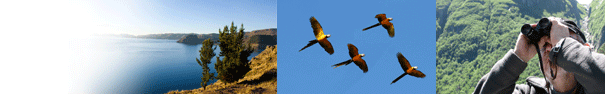
The climate is harsh and species diversity limited, but some spectacular
birds await those hardy souls willing to devote a half day or more, braving
the cold, wind and surprisingly brutal sun.
A Christ statue
high above the roadside on the left-hand side of the road marks
La Cumbre at
16 km
past the Miraflores tranca.
The large lake ("Repressa Estellani")
on the left just before the Christ statue is rather barren, but a few Silvery
Grebes and various waterfowl are usual. Bright-rumped Yellow-Finches are often spotted on the shoreline. The best strategy is to
take one of the dirt roads branching off from the paved road. Amid the rocky
moonscape are cushion bogs and small lakes. The cushion bogs are often better
in wet season, as they can dry out in dry season. Cushion bogs also attract
locals that gather the rich topsoil. Unfortunately this practice is slowly
destroying the bogs. Crossing the bogs will yield typical highland Andean
species associated with water including Puna Ibis, Andean Gull, Andean Goose,
Andean Lapwing, Crested Duck, Speckled Teal, and possibly Andean Snipe or
even Diademed Sandpiper Plover. During the colder months or during heavy
snows, Rufous-bellied Seedsnipes often descend from the scree slopes near the
snowline to feed in the bogs. During the austral winter, the barren ground
around the lakes and bogs is a mecca for ground
tyrants such as Ochre-naped Ground-Tyrant. Over 200
Ochre-naped ground-tyrants were counted one July
day. Slender-billed Miner is a specialty of the area, while Puna
Ground-Tyrant is a year-round resident. Puna Tinamou can be heard calling from the hillsides. Also, keep a lookout above as
Variable Hawk is common and a Black-faced Ibis fly-over is even possible.
Logistics Leave
La Paz
via the neighborhood of Miraflores,
taking the road to Coroico. At the Miraflores police tranca reset your odometer (
0.0 km).
At
8.2 km
pass a large, nearly lifeless, reservoir on your right. Continue climbing on
the paved highway, and at
13.4
km, turn right at a dirt track for the largest expanse
of cushion bogs (not visible from the road). The turn is just after the
overhead power lines cross the road and is marked by a small sign that points
to "Turbera." In less than a kilometer, the dirt track divides. The left fork goes to
the large cushion bog (another
1 kilometer further) and the right fork goes to a series of very small lakes (about a
half kilometer after the fork). The right and left
forks are actually part of the same circular road, but there is a stretch of
200 meters that is
difficult to negotiate in a vehicle.
Returning to the paved road and continuing on,
La Cumbre (the
Summit) is marked by a
large Christ statue high above the roadside on the left-hand side of the road (odometer at 0.0 km). At
La Cumbre there is a small dirt parking area on the left just before the long descent. From this parking area, a small, rutted dirt track winds up to the start of the Choro trail and several interesting high-altitude lakes and bogs.Look at boulder field on broad right hand turn for Short-tailed Finch, etc (4.1 km). Bog on Left hand side of road has Streak-throated Canastero (6.5 km). Control post (narcotics) at 8 km, Scribbled-tailed Canastero site on left hand side at 13.4 km. Pongo parking area at 15 km.
GPS
reading at
La Cumbre parking area: S 16 20.273' W 68 02.434' |